| Start
Intro
Day
A9
Day A11 |
| Day A10 - Back to the
coast |
| March 7,
2013
Pas de Courtin to Carqueiranne
15.5 miles |
 |
It rained not a bit today, and you couldn't have imagined a calmer day either. On both those scores, the forecast was quite wrong. And to think I could still be in Cogolin, whereas my two days defying the forecast have gained me 18.5 miles on Wednesday, and 15.5 miles today (Thursday) to reach Carqueiranne. Just imagine what might have been if I'd been hobbled by the forecast for both days: In Cogolin the hiker sat, In Cogolin the hiker's view In this modest offering, I assume you'll overlook that Carqueiranne does not really rhyme with pain, except in American French. Last night's dinner in the hotel was a
disappointment. But the Hôtel
les Mimosas excelled at a hot bath and a gushing room
heater. Both gave me every possible help with clothes washing and
drying. Though I had to segregate some damp clothes from the dry ones
this morning, I emerged from the hotel in better housekeeping shape
than I expected from yesterday's drenching. Even so, I was careful to
apply athletes' foot ointment. Hobson's 3rd theorem of hiking is that
boots that seem dry are often wet.
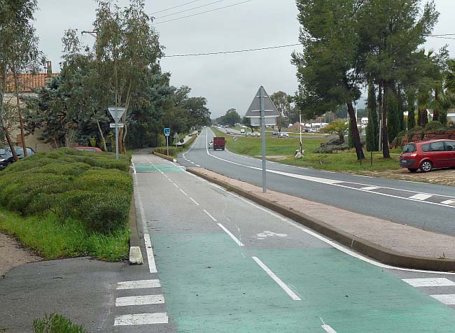
If you've followed me on the map, you'll know that I left the coast in Port Grimaud, a few miles before Cogolin. There I struck out across hilly country to avoid a particularly circuitous and indirect section of coast. Last night, at Pas de Courtin, I was still quite inland. However, today, I reach Hyères on the coast, and stay at Carqueiranne which is a coastal village some miles before the naval port of Toulon. It was a BTD (bike track day) today, which relieved most traffic concerns. The tracks hereabouts are separated from the roads by, variously, a barrier or a wide grass verge of maybe 25 ft. In other words, you're not usually sharing the road but have your own. Among the benefits of a secluded bike track is that pee-ing is more private. After I was about halfway, something niggled my mind about a few switchback turns that I knew were on my descent to Carqueiranne. I remembered there was quite some height drop involved. Yet, here I was at my halfway point, and I was clearly on the coastal plain, as evidenced by Hyères airport and other signs. Now Hobson had long ago taught me the 2nd theorem of hiking, which is that what comes down must first go up. And I knew I could avoid the "up" if I just cut across to the coast on D12, and hung a right when I saw water - or, for map followers, took D12 and then D42 all the way to my destination, i.e., I would gain effortless navigation to boot. There was just one little mistake in this plan, and it was all psychological. Somehow, when hiking, it's helpful to have some waypoints nicely in one's thinking. Then you come up to them successively, mentally checking them off ("job well done"), and not filling one's head with the oh-so-long distance to the night's stop. Well, due to my sudden re-plan, I didn't have those waypoints in mind. So the last 8 miles - and remember that's 3 to 4 hours - seemed to drag - even though I followed the Mediterranean almost all the way - and what would so many people have given to do just that? Hobson's 1st theorem of hiking will be quoted here as soon as I've thought of it. |
| Start Intro Day A9 Day A11 |
© 2013 Daryl May |