| Start
Intro
Day
A15
Day A17 |
| Day A16 - Back to the
country |
| March
12,
2013
Vitrolles to Martigues
15 miles |
 |
 |
 |
|
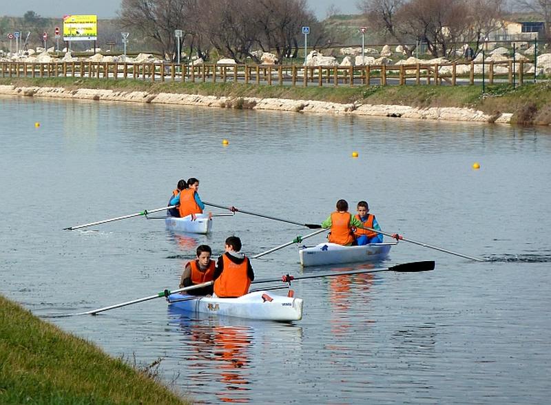
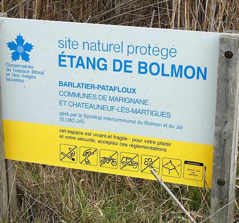
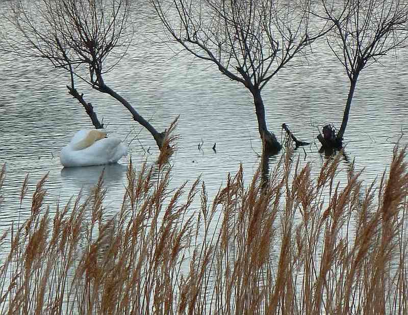
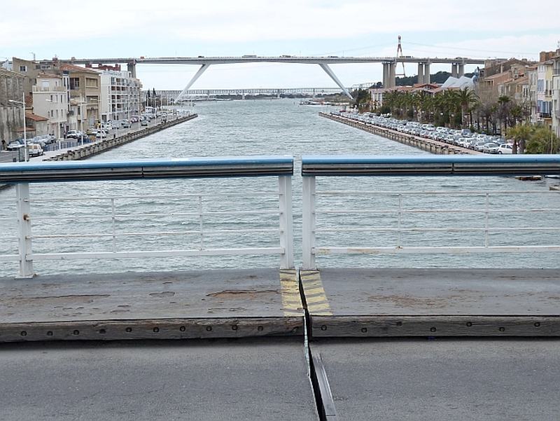
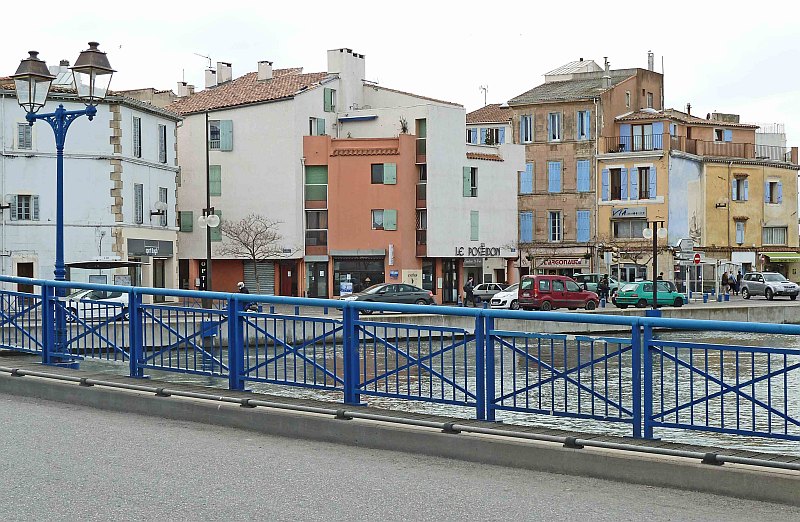
At Marseille, the French Riviera ended. It had surpassed my expectations. While there are plenty of resort areas ahead, there won't be quite such a procession of hills and promontaries, world-class beaches and bays - cradling delightful towns with luxuriant vegetation. Today, as a hiker, I felt things were, at least temporarily,"in the groove". Fifteen miles (again) in seven hours; I felt fine - never got lost, no other drama, and enjoyed every minute. Of course, it helps to have good weather and the right route. The weather was cool, with no wind - and the route was flat, varied, interesting, and mostly untrafficked. In Vitrolles, I stayed in the Comfort Hotel - with tonight's destination to be on the north edge of Martigues, in the Balladins Hotel. I had the route prepped in my mind so I scarcely needed to review it and never needed the GPS. I mentioned that I liked waypoints as psychological "reward generators". Let's review today in those terms. The first thing was to get away from the airport. That was actually no small feat, given the intersections involved and the need for safety. I figured my first waypoint was the point when I was west of the airport's perimeter fence. The second waypoint was a bridge over a canal 1.5 miles west of the first waypoint. Once I crossed this bridge, I could get on to lanes and trails. But what a bridge! It handled a train route and two lanes of road traffic, but not at the same time. I will leave out the details - but think "old bridge, pressed to handle bigger and bigger loads". Turning right immediately after the bridge, I first passed a school rowing center (in use), and then a swan landing and takeoff training center administered by the swans themselves. A couple of them flew right over me to their own considerable applause, the sound of large wings flapping. The third waypoint was entering a wetlands conservation area that ran two miles next to the Etang [lake] de Bolmon. There I got an opportunity to sit in a hide and watch some birds asleep on the lake. I also tiptoed past a couple of school groups, dutifully sitting on the path itself so as not to trespass on to the protected grassy area. The fourth waypoint was leaving this conservation area. Then I passed some local farming and light industrial areas, and a dechetterie [refuse drop], arriving on to the D568, my fifth waypoint. The A55 freeway has taken traffic off the old D568 which has left the small town of La Mede rather high and dry - but peaceful. Staying on this road, here named the Ancienne route de Marseille, brought me to my sixth waypoint, the island that is at the center of the city of Martigues. Now Martigues is quite interesting geographically, because the island is actually in a canal that connects a largish inland lake to the Mediterranean. There is at least one drawbridge that allows ship traffic to access the inland lake, and people to reach the island and points beyond. Martigues is something of a tourist attraction. My seventh waypoint was two miles on, the hotel. There's a large wintry weather
system that's heading south from northern Europe. Having dumped snow
and brought high winds, it's affected much of France already. It'll be
surprising if it doesn't affect me sooner or later. For the moment, the
forecast says I'll have clear-enough skies but 45 mph headwinds for the
next three days. That's a lot of wind, and I hope it's not going to be
gusty besides. |
 |
 |
| Start Intro Day A15 Day A17 |
© 2013 Daryl May |