| Start
Intro
Day
A22
Day A24 |
| Day A23 - Causeway
with a cause |
| April
24,
2013
Palavas-les-Flots to Sete
13 miles |
 |
 |
 |
 |
This morning, I encountered the Palavas-les-Flots
slant on the continental breakfast. Did I want an express one or a
complete one? Now Hobson is no fool. Hobson needs calories and lots of
them. So when the complete breakfast seemed, err, incomplete, he asked
politely if this was the express or the complete breakfast. They say
you shouldn't ask a question unless you already know the answer and how
you'll respond. I didn't and I didn't. "When we say it's the complete
breakfast, it's the complete breakfast, Monsieur." With
that answer, you can serve five inches of baguette, a shotglass of
juice, and a small coffee . . . and that's just the way it was. The
express breakfast had no juice and a smaller coffee.
I was on the road by 8 am this morning, because I had a long hike on another canal towpath on which I wanted to leave time for any surprises. Here the Canal du Rhône is actually built inside a sequence of lakes that stretch along the coast with only a narrow spit of land as their barrier to the sea. In other words, looking from the sea towards the mainland, you have as follows:
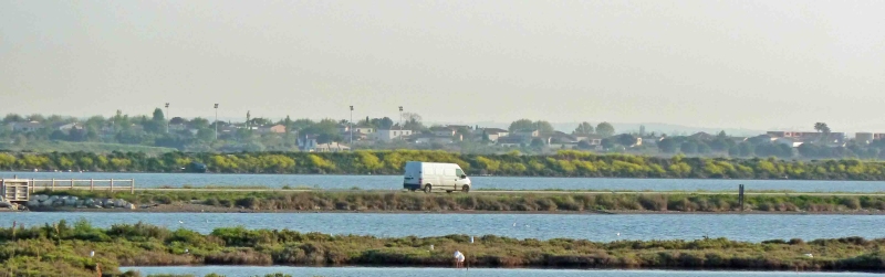
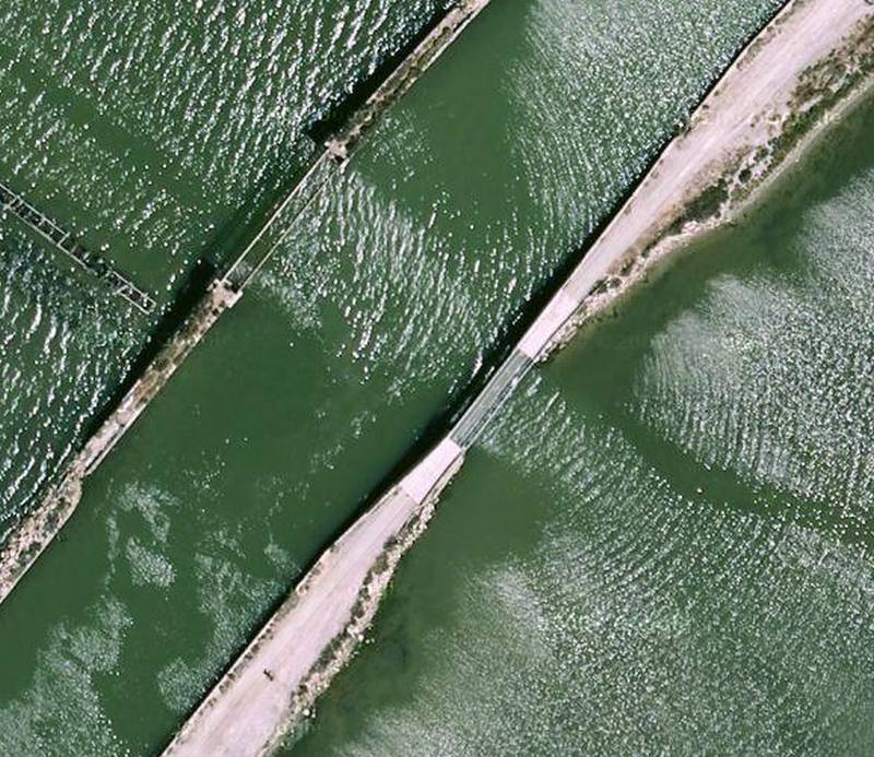
Now you might wonder why there's a canal at all if there's a lake made up of those two expanses of water. And wonder even more when I mention that both canal and lake in these parts have the same water level (no locks between them). The reason seems to be that the lakes are shallow and silted in places, while the canal can be kept deep and less silted. Then, there's always the fact that boaters steer more accurately with land near them. Marker buoys don't deter half as well as that good old running-into-land, oops-there's-a-hole-in-my-boat feeling. The bottom line for the hiker is that he gets a straight shot route to Sête, but must walk for seven miles on a causeway/berm in the middle of a mile-wide set of lakes, the only "companionship" being the berm on the other side of the canal. Moreover, for five of those miles there is no road on the coastal spit - but when there is, that's the beach and more interesting to walk on - but there is no reliable road on the mainland for a fair distance inland. The mainland roads carry all the through-traffic and generally pass through the city of Montpellier there. Walking alone on the causeway is not quite like walking the Atlantic on a surfboard, but it makes one feel pretty small. The larger berm which holds the walkable path is not narrow, but nor is it wide. It's about 50 ft across, so I didn't get the feeling I needed to take care lest I'd actually slip into the water. But, from time to time, a stretch of berm narrows and ends, and there's a 50 ft long bridge to the next one, some of them as narrow as 10 ft. I walked more quickly and more deliberately in these places. As I think I explained, I've gotten remiss about enroute photography - unless I'm really in the mood and the weather is conducive. A photo from Google will have to suffice. I've gotten into the habit of using the "walk" setting of Google directions as a check on my route plan. Occasionally, it will show a shortcut I'd missed, or expose a stretch that's unwalkable. But, today for the first time, it wanted to take me on a detour that I didn't think necessary - into Frontignan for no reason, adding 2 miles to my day. Knowing that Google is usually right, I checked and rechecked, and even followed "my" route on Google's streetview photographs to look for road-closed signs, gates, or sinkholes, or private-road signs. Try as much as I could, I was unable to see my error or make Google's directions conform to my own. So I walked mine and saved the 2 miles without any trouble. Today was therefore 13 miles and not the 15 that I'd once expected. I could have left Palavas an hour later. The shorter distance was a pleasant surprise also because my left-heel blister has been hurting again. I got into Sête at about 2 pm. It was warm, sunny and calm under blue skies that screamed to use suncream. I'm staying at the Ibis Budget, a chain of serviceable newish hotels that, in this case, is in Sête's industrial zone east of town because Ibis Budget guests are generally short-stay business- and trades-people just looking for a clean bed, ensuite facilities, and breakfast. The outlook from my room is of cranes, trains, junk and liquid storage tanks probably not full of milk. I'll probably walk into town later for some canalside seafood and beer. On a previous visit to Sête, Jennifer and I did that together, so I'll feel quite lonely. |
 |
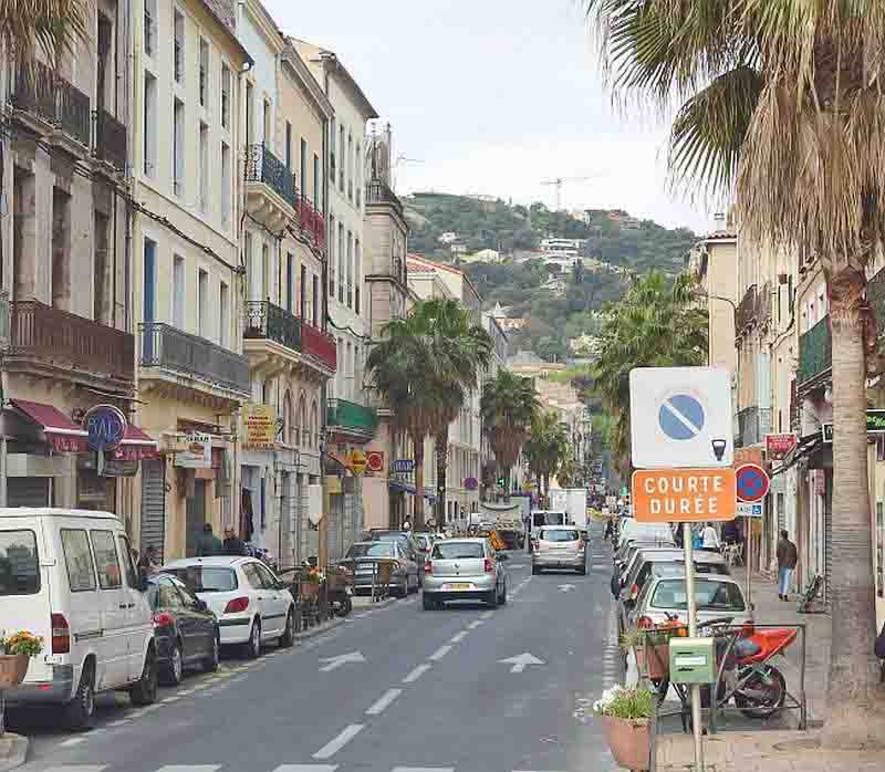
| The city shot below is of Sête. The aerial shot of the canal near the top of the page is courtesy of Google maps. |
 |
| Start Intro Day A22 Day A24 |
© 2013 Daryl May |