| France intro < Previous page Next page > |
|
Day
8 - Hobson hunkers down,
then emerges to right a wrong |
| March
10, 2010
Carcassonne to Bram
14
miles |
| Day
numbers
refer to walkdays. Days not walking are reported in the text
for the nearest walkday. This report covers rest days between Day 7 and
Day 8, as well as the Day 8 hike. |
 |
 |
 |
 |
Sunday, March 7, 2010
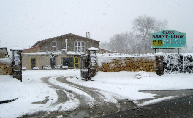
In the morning, my stomach ache had receded, as had my thirst, but I felt weak. Nevertheless, with last evening's calculation running through my head - and the notion that the snow forecast for tomorrow might soon dictate a rest day whether I wanted one or not - I set out. Fortunately, a decent breakast which included yoghurt, cereal and fruit was compatible with my picky appetite. Now one way that I check my stamina is my need for rests. Typically, I don't even think of taking one for the first two miles - but not this day. By the time I had just passed Carcassonne airport, scarcely a mile from the hotel, I spotted one of those perfectly-graded grassy banks - of the sort where one can deposit one's rear and somehow still have room for one's pack to nestle in the grass and support one's back. Mind you, I think I would have sat on that grass bank anyway, even if it had been one of those hiker-category-13 grass banks covered in nettles and with mud that excretes through the grass when you sit down. Rising from my rest, alert to what the rest of the day might now be like in spite of fine weather, I set out down the road. As I started, I knew I needed to check my map to make sure I took a right turn beyond the airport to head north towards the canal. This road was too small for me to depend on a signpost. And that's when the map gave up on me, crashing the PDA as soon as I got into the program. When this repeated itself twice, my plan-B - based on my mental picture of the route - was to take either the canal (which has no signs to indicate when I should leave it to head for my destination of Bram), or the main road. Either choice made maps unnecessary, but would be a poor one. At that moment, the lack of maps was not just a physical problem, but a psychological blow. (I solved the problem later at the hotel.) Now, as many people know, France is not a good country for hitchhiking. Country roads aren't much trafficked, and there's something in the French culture that makes drivers as reluctant to offer rides as are Americans. And even if hitchhiking had entered my head - and it had - it surely wasn't compatible with hiking. But it was impossible to ignore a miracle! Just as I was struggling down the road again, a Nissan SUV stopped, and a very generous man actually volunteered a ride. And I accepted - the hiker's ultimate sin. (I righted that wrong later - read on.) Within an hour of setting out, I was ensconced in my hotel room at the Hôtel Clos Saint-Loup in Bram, ready to resume my recovery. I spent most of the day sleeping, and most of the night, too. It was a strange sojourn - at a country motel, the only guest, behind locked gates since the hotel closed early. Sunday in France is still a family day. It snowed through the night. Monday, March 8, 2010
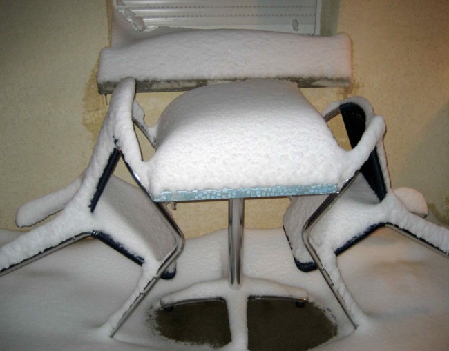
It snowed all this Monday, too. The television was full of it. I was in one of the seven départements that the central government deemed en vigilance orange. For unnecessary emphasis, the television weather map showed snow flakes superimposed on the orange. They reported that six thousand travelers had been bloqués pour le nuit, including several hundred motorists trapped in their cars. In the evening, they reported alerte orange maintenue. I ventured out just to walk into Bram in an abortive attempt to buy a top-up for my phone service, finding it a trudge through uncleared snow. As I write this on the evening of March 8, the snow seems to have tapered off. But it also seems quite doubtful that tomorrow's warming trend will dispose of so much snow and slush in time to walk. We will have to wait and see. Meanwhile, I pondered my situation. One thing was clear, and that is that it wouldn't be right to claim I walked "the distance" if I didn't. So I had two choices: to go back to Carcassonne and walk to Bram; or to turn this hike into something that wasn't "all-hike". I decided to go back to Carcassonne. Even if I were trapped in snow for a couple more days, and then returned to Carcassonne to walk to Bram, it was just something that had to be done. The lights flickered in my room, threatening a power outage that would take the heat with it. That never quite happened. Tuesday, March 9, 2010
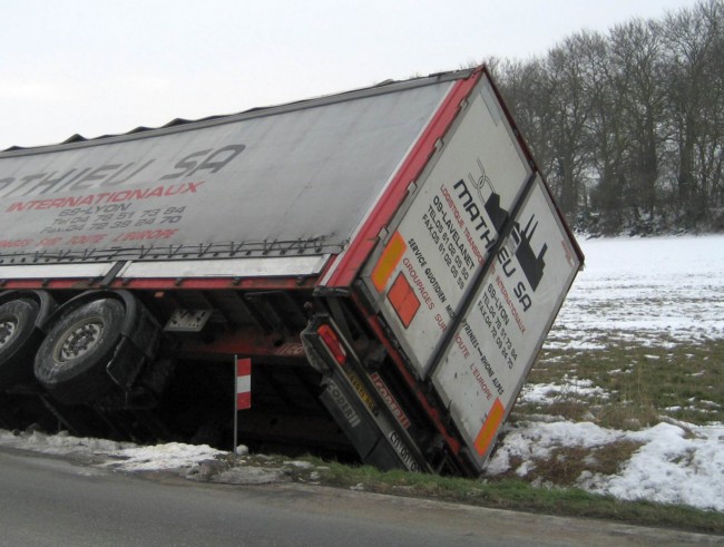
One look out of the window at 6 am confirmed that I needn't get up early this morning. Over a leisurely breakfast of café au lait and the usual, I read La Dépêche. It reported that the snow had ended, leaving 20 to 50 cm on the ground (8 to 20 inches). I confirmed the 8 inches right outside my room with a measure, but never saw 20 inches. The département of Aude (which I'm in) was bloqué par la neige, with Carcassonne paralysée. 350 semi's had been forbidden from the highways, and by a law of unintended consequences had now jammed the towns. Several hundred people spent the night in shelters. The newspaper photographs showed carnage on the highways. Having once lived in Montréal (Canada, not the one three miles from here), one gets a sense for how long it will take for snow to succumb to rising temperatures. This morning, temperatures will remain at freezing, with a rise to maybe 40 degF (say 5 degC) this afternoon. That's probably not going to melt all this snow, and cooler temperatures tonight won't help. Road surfaces will likely transition from snow to running water under the forces of cars and snowplows and perhaps salt. But what about canal tow paths and road verges? Well, the canal tow path will be impassable whether it be under snow or muddy slush, and the road edges may be a mixture of slush and ice. It's not an appetizing picture, or a safe one. I will have to wait for the morning to see if it's worth hopping on the train back to Carcassonne in order to try to walk the 14 miles (21 km) back to my present abode in Bram. There are no halfway stopping places, and that's a long walk in poor conditions. Poor conditions? La Dépêche forecast mentioned violent winds. And now for some mea culpa. Friends who told me that March was too cold for the Mediterranean . . . were right. One friend, Mauro, tempered his wisdom by saying that it might be fine, but French weather is unpredictable . . . and he, too, was right. Mind you, Mauro advised to hike In Italy, but I've noticed that Corsica, closer to mainland-Italy than to mainland-France, is gripped by the worst snow of all. Nevertheless, I have scant experience with French weather, and judged it mainly by reference to latitude and elevation (less than 500 ft), and temperature stats. Those hadn't been enough to judge precipitation and wind. To my friend, John T, who was about to go ski-ing in the French Alps with his family, there was only one thing to say: "You've got it made, pal". As an American who has hiked in Britain, one of the themes that has emerged in email with those planning such a hike . . . is the difficulty of hiking in a foreign land. That's a reference, of course, to logistical matters like local transportation to one's start point, cellphone providers and policies, accommodation reservation practices, and the like - and the fact that you can't just pop home for the weekend, or call on friends for rescue, or casually see a doctor. As you can readily appreciate, that's even more difficult in France. And it's nicely illustrated by the difficulty of topping up my cellphone account which is now at an unsafe zero. At my most recent wifi-equipped accommodation (and I have no wifi here in Bram), the cellphone company declined to accept my credit card. So I tried two other credit cards in vain, before it blocked me from further use of credit cards for having attempted to use too many cards. Moreover, they want proof of my residence here in Tampa, USA, France. But there's one way around this which is to pay cash at one of their 20,000 Tabac outlets in France, which are listed on their website. Or maybe not. Trudging through the snow yesterday to 17, ave de la Pôste, which fortunately was open, I asked to top-up (recharger) my Mobiho account, the word being in itself a foreign term. But, "non Monsieur, we do not sell Mobiho top-ups, and who is Mobiho? We can sell you Mobisud" - which would have been a nice way to sell me a credit on a service that I'm not signed up for. So, back home, Jennifer tried to call Mobiho to make some headway for me, but found their phone number had a full mailbox. Back home, I wouldn't have had to switch from my Verizon phone and service. Of course, it's all more difficult in a foreign language. My French is poor, though under necessity it's coming along well. Most of my conversations are now in French, though of exécrable quality. I guess it's a compliment that the other party doesn't feel they need to break to English to help me out. But, in some situations, I'm still defeated, and sorting out the cellphone problem isn't high on my comfort list. Heck, these people market the Mobiho service especially for visiting Americans, and then give them the runaround. So even if I can communicate with them, I bet they'll want a hiker with no support system to get them a copy of his Aunt Agnes's drivers license, and send in an affidavit that 17, ave de la Pôste in Bram will not sell him a Mobiho top-up. My plan is to find a Tabac at my next port of call who knows who they are. And, after that, I'll be able to book accommodation again, which is pretty well a necessity in this weather. . . . and, finally some hiking: Wednesday,
March 10, 2010
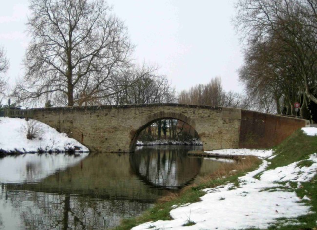
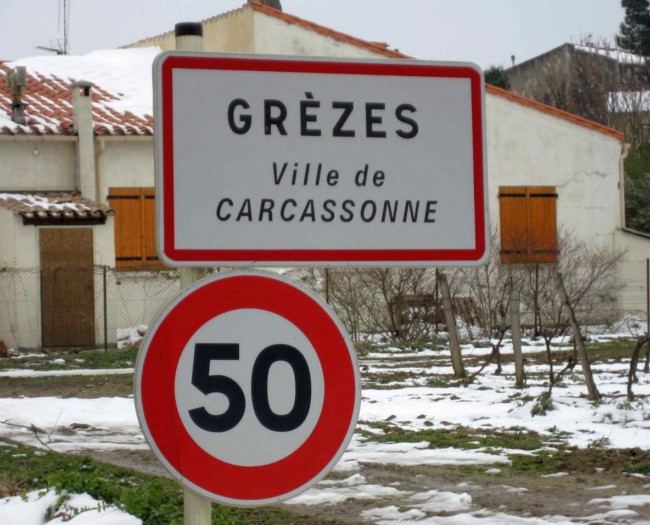
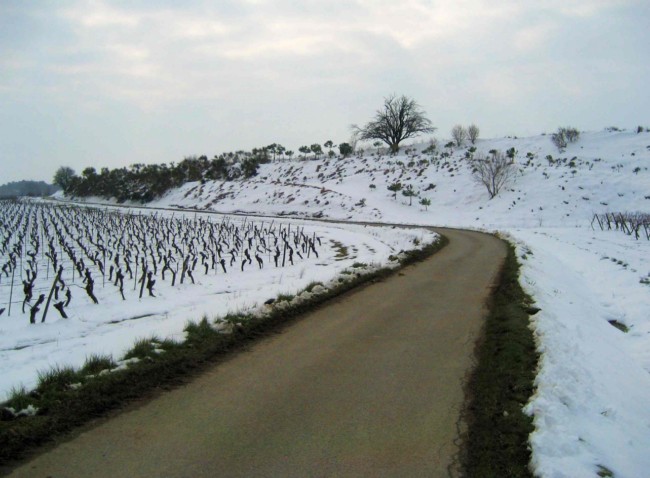
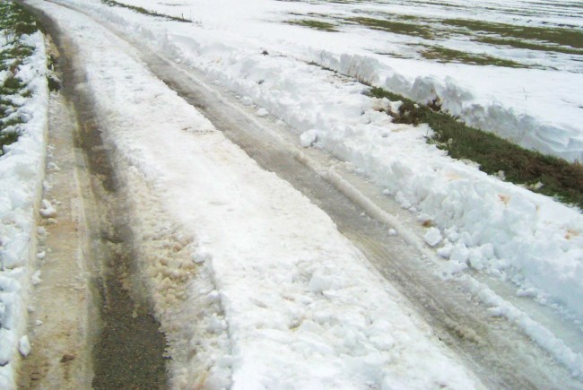
Overnight, Hobson cooked up his plan. The challenge was the morning, at which time the snow would likely still be around on the shaded canal. It would also likely be on the verges of the main roads, such as the D33, that are far too trafficked to walk undisturbed on the roads themselves. But there's a class of road best described as a country lane. According to Hobson's théorie, such lanes will be free of snow, and lightly-enough trafficked to walk mainly on the road surfaces themselves. Fortunately, there are such for the middle portion of March 10. Hobson's plan is to take an early train to Carcassonne - they exist, and hopefully they're running. Then somehow get to the airport and set out from that March 7 stopping point. If you're following the route, and here it is, you could start by typing in the villages of Grèzes and Métarie Neuve, one or other of which should be visible just west of Carcassonne airport. You'll then notice a country lane to Caux-et-Sauzens. At Caux, there are choices of southerly or northerly routes heading west to Villeséquelande, one of which will seem better than the other at the time. At Villeséquelande, I will have covered about 4.5 miles or 7 km, and must make other decisions. Here I have a choice of a long haul on the D33, which my maps show to be relatively narrow and possibly risky - or an even longer haul along the canal which at least appears to have one decent towpath on its northern side. Much will depend on the surfaces at the time. If I choose poorly, there's an opportunity to revert from one to the other where they come close to each other south of Ste-Eulaliè. Regardless of the preceding, I do need to leave the canal for the D33 where the two cross somewhat south of Alzonne. At that point, I am 2 miles (3 km) from the turnoff from the D33 to my Bram hotel. It just wouldn't make sense to add a mile to that by staying longer on the canal. Just west of the canal and D33 intersection, the D33 widens anyway, which suggests a decent shoulder. We will see how this plays out. You see, here, a glimpse of why good and quickly-accessible, maps are helpful and why I've put so much effort into getting that capability. I hope the towns show up on your Google Maps as well as on my French IGN maps so you can follow along if interested. Unfortunately, Google Maps can't be used whilst hiking unless you have an Internet connection on the hoof. With his backpack on, Hobson is a beast of burden, plodding across the landscape with the vigor of a mule. Without his pack, Hobson is a racehorse. Planning to return to the same hotel in Bram let me leave my pack there. I loaded the pockets of my coat with all I needed for one day. I left the hotel at 5.50 am to catch an early train to Carcassonne. In difficult weather, it's better to start early when winds are subdued, and there's plenty of daylight for any eventuality. But I was confronted by the locked gate of the hotel, and no lighting with which to find the way to open it. Eventually I found the right buttons on a nearby wall, and walked into town where the station building and its ticket office were closed. With the 6.23 am train due to leave in moments, I went to the platform anyway, where at 6.30 am they cancelled the train, with another to arrive at 7.20 am. It was perishingly cold, clearly "subzero". Later I learned that it was about -5 degC (23 degF) at that time, rising to only 2 degC (36 degF) that day. Another couple of passengers strode off - probably to nearby warm homes. The train at 7.20 gave way to the one at 7.56 am, so I had sacrificed my hotel breakfast for nothing by leaving early. The ticket office did not open until 9 am, but another passenger explained that there's a process précise for this situation if you haven't bought a ticket earlier. The process is to hope that there's no ticket collector on board, because he'll charge you the fare and add a penalty. The train was heated but I was still frozen at Carcassonne, where the station was barely heated. I ate a couple of my apples and dipped into my raisin supply to load a few more calories. The violent winds which the paper had mentioned had been detailed on the television to be 90 km/h in the morning and 100 km/hr in the afternoon. That's a blistering 56 and 62 mph. Moreover, the wind arrows on the TV screen had shown them as headwinds. During the night, the shutters on my hotel room had clanged, but in the morning things had been calm enough. At the forecast levels, I would never have ventured out. At a modest 20 mph or so, I reckoned I'd need to chance it. Surface conditions were pretty well as I had expected, though the mud was simply iced-up, so not really a factor. Puddles were sheets of ice, and to be avoided so as not to slip. The sidewalks were usually impassable with frozen, uneven slush, but the roads and most of the canal towpaths were quite walkable. When crossing the canal, I avoided walking across the lock gates, because I wasn't quite sure where to step with the snow still on them, and waited to cross on road bridges instead. Traffic was slight. I judged that French motorists, like the train drivers, had reckoned that a good lie-in wouldn't unduly stretch the tolerance of their employers. One thing was also clear, and it made me glad I hadn't try to do this stage of the walk while feeling unwell: the country lanes aren't signed. So, between Grèzes and reaching the D33, I had to mapread every half-kilometer or so, making many decisions that needed care. In Caux and near Villeséquelande, I had to get directions at the Mairie (town hall) and from the locals. But, just as planned, for the middle-third of today's hike, I could walk on country lanes with almost no cars at all - just two, in fact. Grèzes has a town sign (pictured here), which offers an interesting lesson in French - if, that is, you're down for it. If not, skip on. Now, in French, upper case characters are not usually accented - just optionally. So Grèzes could be capitalized GREZES, and that would be perfectly good grammar. The sign compozers in this case were smarter than to do that, and here's why. There are numerous ways that Grezes could be accented, each resulting in a quite different pronounciation. By accenting the upper case sign, they made the pronounciation clear: GRÈZES
("Grez" in phonetic English).
If they hadn't accented any letter, the following are some of the implicit possibilities, along with their pronounciations, according to Hobson's lexicon, not that it's authoritative. And we won't even start considering Ê. GREZES (Greaze)
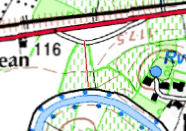
GRÉZES (Grayz) GRÉZÉS (Gray-zay) GREZÉS (Gree-zay) GRÈZÉS (Gre-zay) The accompanying map shows (in red) a short 125 yard portion of open country that I'm particularly glad I didn't attempt when unwell - and with a backpack. I needed to leave the canal and get on to the D33 here, and faced just a farmer's field though covered in snow. The first few steps into the field were fine, but then I sank to my thighs, with succeeding steps no better. Having no pack on, I was able to lean on to my back, and get my legs out. Getting up on my feet wasn't possible in the soft deep snow, so I had to roll. A short distance away, there were mounds of mud, showing the way to soil and not snow, so I rolled in that direction. Getting up was now possible, and I stepped more carefully the rest of the way. Mud has now risen on my list of valuable commodities. In fact, mud is now my friend. Hobson learned today that oven mitts may be better than nothing, but do not cut the mustard as far as cold protection. But he also learned that mitts can serve more purposes than gloves. For example, when you're not wearing them, they can hold objects like water bottles and sunscreen. Along the way, Hobson was finally able to buy a top-up for the cellphone. So, on a mixture of country lanes, canal tow paths and the D33 (not a major road here), Hobson arrived back at the hotel in the early afternoon ready for some industrial-strength central heating and his afternoon nap. He had walked off every inch of last Sunday's car ride, expunging the sin. |
 |
 |
 |
 |