 |
Intro
to My Hike in France |
 |
| Start Website home Part B (Agde to the Atlantic) Part A (Italian frontier to Agde) | ||
 |
||
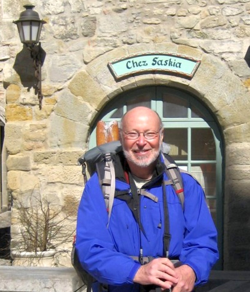
Author at Carcassonne, facing a fierce winter sun |
||
I am a retired aerospace engineer with geography and writing interests, who sometimes hikes. After I retired, I had time for the hikes I'd just dreamed about. In my thinking, a meaningful hike is a long-distance one. In
2007 I hiked the length of Britain from south to north, about
a thousand miles - and
in 2008 hiked in the other direction. The hike
described here is across
France from the Italian frontier on the Mediterranean to the Atlantic
coast beyond Bordeaux.
I started in 2010 when nearing 67 years old,
covering "the second half" (Part B) first, and then walked the "first
half" (Part A) in 2013 when nearly 70 years. The combined distance is
about 700 miles.
I
found these
hikes really arduous, even if they're easy for others. But I
got great satisfaction from finishing them. For me, they were the
humble equivalent of epic journeys. So this account is not
about
a stroll in the park, or relaxing as a tourist, or even a weekend in
the woods. It's hardly even about
sightseeing. It's about the personal drama of
covering
long distances, often in poor weather, solving equipment problems, and
enduring aches and pains, as well as about coping with life in a
foreign land and a foreign language - including the logistics of
finding
accommodation and food
- without transportation or onsite support.
With that as background . . .
Or skip all the words, and click slideshow. |
||
 |
||
|
.
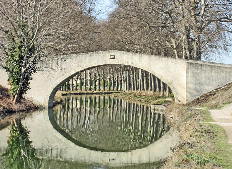
Bridge at Gourgasse Vielle, Canal du Midi
Before there were ship canals,
there were barge canals. A famous pair of such canals and rivers connected the Mediterranean with the Atlantic, enabling vessels to circumvent the Iberian peninsula (containing
sometimes-hostile Spain), saving 1400 miles in the process. Barges of up to 100 ft
could now reach the
hinterlands of southwestern France which became part of the world economy.
My route followed the famous Canal du Midi from the Mediterranean to Toulouse (about 150 miles), but the waterway and my hike did not end there. At Toulouse, the Canal du Midi joins the less-famous but still impressive Canal latérale à la Garonne (or just Canal de Garonne) for an additional 125 miles until the Garonne river can take over. The Garonne river then flows into the Gironde estuary, which runs to the Atlantic (another 100 miles), all subject to tides. In combination, the Canal du Midi and the Canal de Garonne are known as the Canal des Deux Mers (Canal of the Two Seas). Discussed since Roman times, and planned since 1516, the Canal du Midi portion was arguably the biggest construction project since Roman times when it was completed in 1680. Canal routes are inherently
level, save for locks, so the
route climbs slowly to an elevation of just 620 ft at the
Continental Divide before it starts an even slower descent towards the Atlantic. Exactly at the Continental Divide, a
feeder canal supplies water
from a large dam in the mountains. This water supply, which was key to
the success
of the whole project, replaces water that would otherwise drain to the
two seas or be lost due to irrigation and seepage. As one passes the
Continental Divide, the canal water direction changes, and the locks
face in a new direction.
With ample water at hand, the whole route is mostly tree-lined and beautiful, close to vineyards, and tranquil along the canal portions. In winter, there's almost no boat traffic, and few liveaboards. The Canal du Midi is now a World Heritage Site. For long stretches, it's yours alone through the winter. The Part B route starts at Agde, and passes through Béziers, Carcassonne, Toulouse, Agen and Bordeaux before ending at Soulac-sur-Mer on the Atlantic coast within sight of the famous Cordouan Lighthouse. It's about 375 miles long. |
||
 |
||
|
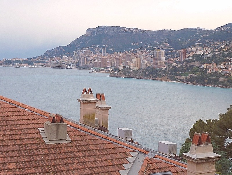
Approaching Monaco 2013 Part A For
its first half, this route follows the Mediterranean and passes through
well-known resort villages, towns and cities. It's almost
exclusively a road route, but has only sparse traffic and few tourists in
winter when I walked it - yet can be jam-packed in summer.
The route is not at all monotonous. Although it generally follows the Mediterranean coast, connoting tourism, in places it remains lightly-populated and rural. Some coastal portions wind tortuously at the top of cliffs and around bays. At other times, the route turns inland and is hilly. Beyond Marseille, however, which is France's second-largest city, it becomes flat. After crossing the Rhône at the Roman city of Arles, one enters the Camargue region with its wetlands and wild horses. Strong winds are common here, and can bring northern winter to the south of France. The winds are often channeled down the Rhône Valley through a funnel between the Massif Central (central mountains) and the French Alps. The initial, resort-portion passes through Menton, Monaco, Nice, Antibes, Cannes, Fréjus, St. Tropez (slight detour), Hyères, the naval city of Toulon (not a resort) and Cassis - and is over in Marseille. Beyond that and pleasant to visit are Arles, Montpellier (if you route that way), and then Sȇte before one reaches Agde. Part A is about 325 miles. |
||
Navigation
and communications
Watching ships leave harbor, and reading about old naval adventures, plus a keen interest in the history of the sextant, explain why I love most everything about maps and navigation. I thought it a wondrous thing when hand-held GPS became available, and even more so in conjunction with moving map displays. My experiences with this evolving technology are documented in this website. On
my 2007 and 2008 hikes, I used a primitive external GPS receiver, which
sometimes connected (slowly) by primitive Bluetooth to my
equally-primitive PDA (Personal Digital Assistant) on which I
had
stored electronic maps. In theory my PDA also had wifi for Internet
connectivity in hotspots - and they sometimes functioned as advertised,
but
often did not. When functional, I typed by stylus on a 3 inch display,
because an external keyboard using an IR (infra-red) connection was
clumsy. This equipment, together with some back-up, and my camera
and phone, needed five chargers. It was all a royal pain. But
the
alternative, as far as maps, was to carry more maps than could fit in
my backpack - or arrange a complex mailing arrangement to receive and
send maps in stages.
By
2010 and 2013, netbooks and tablets, with internal GPS and capable
wifi, made mapping and communication better and easier. By
2013, I could pull my tablet out of my belly-pack, activate it in a
minute, and display my position a minute or two later. Wifi
was de rigueur in France (where they pronounce it "wee-fee"), giving me email and internet
access. Accommodation in just about any establishment could be
booked quickly online. Google maps were now excellent, with satellite
as well as map views - and by 2013 with street views - and I was able
to plan my route on it. But Google maps needs an online connection
to function, and I hadn't found affordable cellphone data service in
France - so, except for some cached map views, I could access
Google maps only
through wifi hotspots. However, I was able to transfer my route
electronically to some decent carry-with maps ("Mapswithme") stored on my own
equipment, so I had a map - with my location displayed - even
when in the boonies.
For
phone service in 2013, I used Skype in wifi hotspots, with which I
could even
call
internationally to change air reservations. I
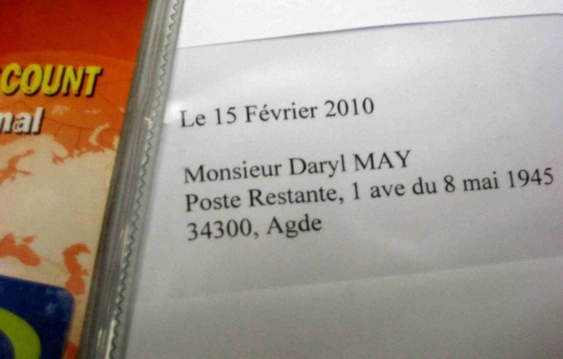
carried a cell phone but used it barely ten times. The
reason to abandon my phone in 2013 was a bad experience with a
prepaid service in 2010. I had problems (described later) from
the
moment I picked up my SIM card at my French
address of Poste
Restante, Agde.
The streets are not a
great place to sort out phone service problems.
After all, you usually need a phone service to get help with your
phone service.
|
||
|
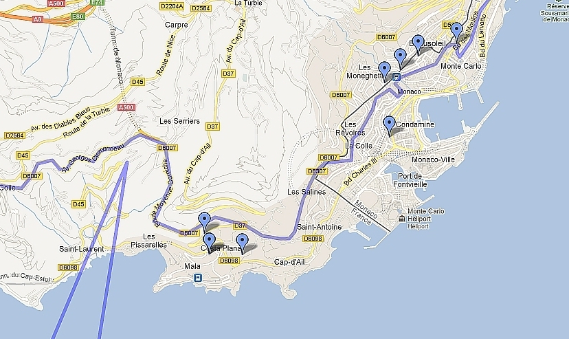
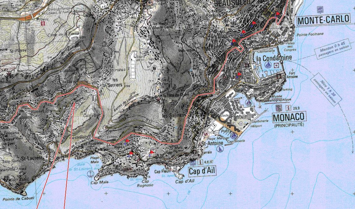
Overlays like routes
can be prepared on one map (such as Google maps - just below)
and electronically transferred to another (like the French IGN map below that). Mapswithme.com is also an excellent and affordable carry-with electronic map program for streets. The route in the maps below is not my exact route, which lay closer to the coast. . |
||
 |
||
 |
||
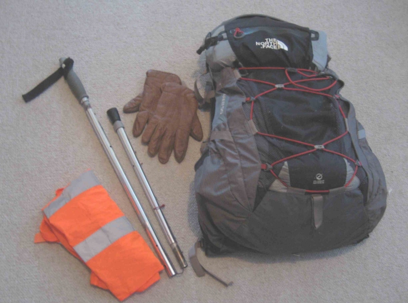
Ready to go - twice
I
talk about traveling light - but don't always walk
like I talk.
It's wrenching to leave behind things that have been essential or
just helpful in the past - medications, blister treatments, electrical
adaptors, spare clothes!
On
my French trips, my backpack - sometimes including a bellypack that can
be carried inside the backpack - weighed about 23 lb when fully loaded,
not including water or food. Over
the years, my clothes have gotten lighter but my electronics have
gotten a bit heavier, so weight reduction has been slight. I still use
the same faithful North Face backpack pictured below, and the same
hiking pole and hats. The Gore-tex hiking jacket I used in 2010 was
comfortable, but I saved weight by using a polyester one in 2013, even
though I took some extra undergarments. As usual, I washed
clothes at night, becoming adept at drying them near the
room heater by erecting my hiking pole between a wall and a door, and
hanging clothes from it. I ought to patent my clothes-drying methods,
which sometimes include any hairdryer that comes with my room. (Hairdryers should never be
allowed to overheat.)
My 2010 hike was partly on soft and wet surfaces, and I used the same Asolo boots as I used to complete my 2008 hike. In 2013, mostly on roads, I tried Merrell hiking shoes. They started well giving me no blisters, ended up usable but moderate blister-makers, and were always pleasantly lightweight. For air travel, I used a kit
bag to hold my
backpack in 2010 - preventing the backpack straps from snagging baggage
handling machinery (as once happened to me). In 2013, I tied up all the
backpack straps and wrapped the backpack in various ways to guard
against pilfering - and this worked well, too. So I was able to leave
the kitbag, albeit weighing only 8 oz., at home. Because the backpack
is so essential to the hike, yet too big to be carry-on baggage, you
can imagine the relief with which I greet it after I land. The backpack
has needed repair at least twice, so I carry a big needle and strong
thread for that purpose.
In 2010, I arrived at Agde by train, worn out by overnight travel and then a train from Barcelona because my flight to Montpellier (near Agde) was canceled. With the time change, and full of antibiotics due to an infection, it made for a horrible first day. In 2013, I reached Menton Garavan station by train, fresh and without a time-change. Here I walked a quarter-mile east to the Italian border, a featureless former customs post now used as a parking lot, where I took a few photographs and set out on my hike to the west. I was three years older than in 2010, and more like a mule than a racehorse, but it felt good to be back on the trail. |
||
 |
||
 |
||
Recommended
reading
More about my route
"Canal
du Midi"
by Jean-Yves
Grégoire (Rando Editions, France, 2007). A book for hikers and bikers,
with descriptions of the route in segments, describing adjacent sights
and some accommodation. In French.
"Voies navigables du Midi" by Par C. Vergnots (Editions Cartographiques Maritimes, Le Perreux-sur-Marne, France, 1986). A book for hikers and bikers, but especially boaters, covering the waterways described on this site in great detail, down to every bridge and lock. In several languages, including English. Both these books describe the entire route between Bordeaux and the Mediterranean. Check Amazon, new or used. Hiking
in France generally
http://walkinginfrance.info
is a wonderfully organized and presented hiking site by an Australian
couple who have walked over 5000 miles in France over a period of ten
years, mostly along the trails described below. In English. Highly
recommended for readability, great pictures, and sound advice.
http://www.gr-infos.com/gr-en.htm lists the Grandes Randonnées, an established network of noteworthy hiking trails all over France, with maps of each. A great trip planner. In several languages, including English. |
||
| Start Website home Part B (Agde to the Atlantic) Part A (Italian frontier to Agde) | ||
© 2010 - 2013 Daryl May |
||