| France intro
< Previous page Next page > |
| Day 1 - A bitter beginning |
| February 26,
2010
Agde to
Portiragnes
5.5 miles |
 |
 |
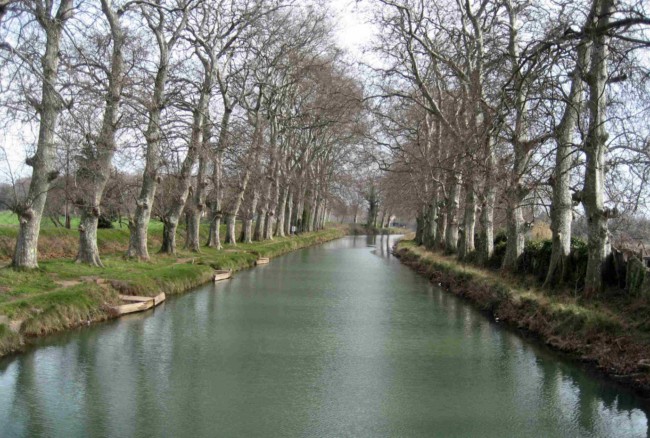
At top is a section of canal near Agde
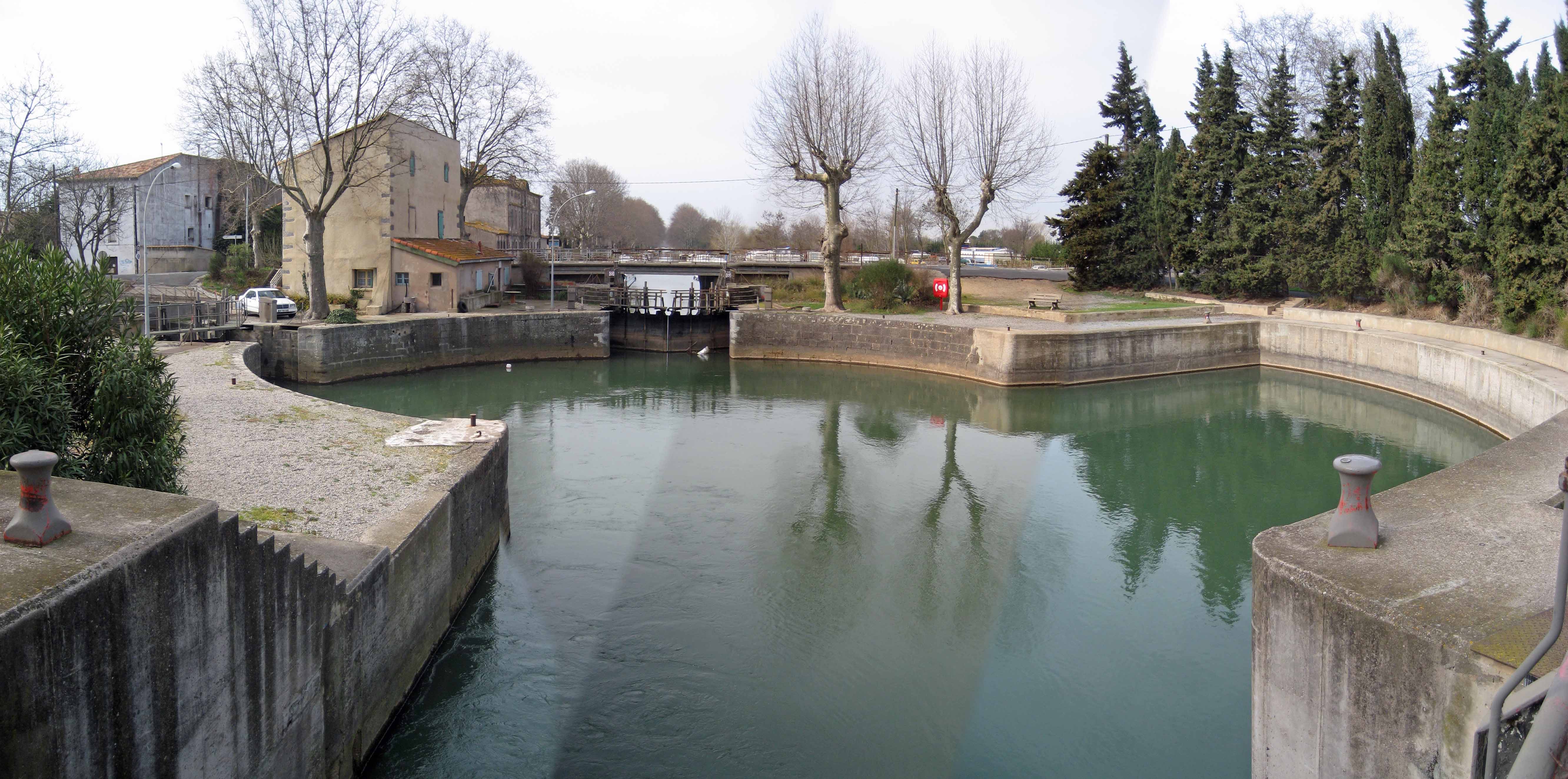
Just above is the well-known Ecluse du bassin rond, or Round-basin lock, at Agde. I took this composite shot while standing on the lock gate which leads to a branch of the Canal du Midi heading east. Straight ahead is the Canal du Midi heading west. To the left is a canal which runs barely a kilometer to the south before entering the Hérault River to the Mediterranean, just 3 km away. In recent years, the lock has been enlarged by extending it to the right where the wide radius permits the turning of 100 ft (30 m) boats. That fact enables the lock to function in multiple directions, but it must take lots of water to operate, and is probably slow to fill. |
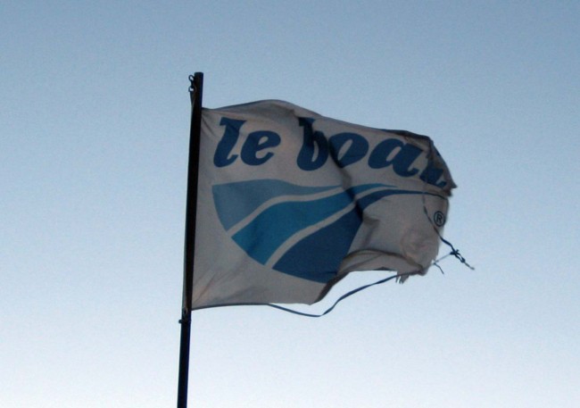
The writing of this is painful. I set out from Agde at about 8 am heading for Villeneuve-lès-Béziers, a modest 20 km (12 miles) as befits the first day of a new hike after some quite grueling travel. The going started easily enough in fine hiking weather - a temperature of about 50 degF (10 degC) under clear skies, and almost calm. It was my first experience of the canal towpath, and here it was well-groomed into a dirt track with evidence of horses and bikes, and mud only in dips. The surface was good along with the weather, and my navigation skills kept me on the correct side of the canal at all times. I quickly learned to treat the canal as a set of sections between locks and bridges. Upon reaching any lock or bridge, one needs to know the correct side to walk to the next crossing opportunity. That's done with maps, because there were no signs, and nor is the condition of the towpath a good indication. A good towpath can lead to a viewing point at a weir where the towpath ends, or at a spur of the canal that heads off in a direction not of your choosing. I also learned, at least where the crossing opportunities are a reasonable distance apart, that navigation is as simple as noticing each crossing point as one passed, because that stamps your position on the map as accurately as any GPS. So even if the canal and canalside were featureless, which is not the case, the map could be a simple one - just as long as it indicated between each crossing point the side of the canal that the towpath existed and continued. The mechanics of this type of navigation were a useful education, because I found that the PDA phone (with GPS and maps) that had given trouble in Tampa was giving trouble again. It would crash, and shut down the phone with it. As I related yesterday, that's why I brought a stand-alone lightweight cellphone. It's also why I brought a backup PDA (with maps, but without phone and GPS). But, having been unable to operate the stand-alone cellphone in France, and with the PDA phone (with GPS and maps) on the blink again here in France, I quickly concluded that I was down to one PDA (without GPS but with maps), and no phone at all, by the very first morning of the very first day of the hike. As it turned out, I solved most of these problems next day (as reported later). But, at the time, they contributed to my worries. Hobson's troubles were not over for the day. For now the wind came up and whistled down the canal towards me. Soon, it was a biting 50 mph (80 km/h) wind which caused waves even on the canal, and bent the reeds and the grass. A flag on a nearby pole fluttered to tatters almost in front of me, and a wooden sign that was hinged at its top bent 45 deg from the horizontal. |
 |
|
For a time, I struggled against the wind, though it was strong enough
to affect my stride. But it made for hard going, and increasingly
sapped my strength. If you've read the account
of the first day of my southbound hike from John o'Groats, you may
recognize the startling similarity of events. But there were one or two
differences. By the time I was pooped in Scotland, I had covered 14
miles (22 km), and here in France I had covered only 5.5 miles (9 km).
Of course the wind had arisen earlier in the day here, but I also felt
disturbingly fatigued - more so than caused by just the wind. That was
the second difference.
After several rests, and restarts, and while the wind showed no signs of abating, I realized I had done enough for the day. That's easily indicated when a rest doesn't reinvigorate. It was clearly prudent to head for the nearest point of real shelter, and probably some accommodation. So, still laboring, I exited the canal at a road crossing near Portiragnes. Here there were no cars to speak of, and the only pedestrian passer-by confirmed what my research had already told me - that there was no accommodation in nearby Portiragnes village. A brief effort at hitchhiking was unproductive. Still feeling totally wiped out, I slumped to the ground to lean my back against a roadside post to consider my plight. The first thing I suspected was that my fatigue was only hastened by the wind. It would have come along anyway a few miles later, and there were a number of probable causes. One was the weight of my pack, another was my only-brief rest-day after my flight, and another was my general fitness level. But the fourth reason that I thought most significant was that I was on a heavy and prolonged course of antibiotics. I set aside the analysis at that point because a more pressing need was how to extricate myself from the roadside near Portiragnes when I could not walk any distance at all, no cars would stop, and I had no working cellphone. Slumped at the foot of that roadside post, I had not noticed that it was a bus stop. Getting up, I saw that there were five buses a day, and one would (or might) arrive within an hour. Rescued almost by divine intervention (though the Lord said "Darn it, Hobson, what took took you so long to notice I'd given you a bus stop?"), I bused into Béziers, where I took the train back to Agde whose Hôtel le Donjon felt comfortable and in the right place. In Agde, I licked my mental wounds as I slowly recovered from my physical ones. On my British hikes, my enjoyment was secondary to finishing the course. And, while they resulted in lots of enjoyment, much of that was in hindsight through rose-colored spectacles. The hikes, while on them, were arduous - though at least my exertion level was sustainable. Here, I was quite sure that my start day exertions could not be safely sustained. Now a little older and perhaps wiser, I pledged that this hike was going to be about enjoyment whilst hiking, and that was whether or not I finished the course. So I stayed in Agde for another rest day, and the following day being Sunday when the buses could not take me back to Portiragnes, I decided to stay Sunday too. Mercifully my course of antibiotics was just ending, and would doubtless clear from my system in a couple of days. Sunday was helpful as far as equipment problems. For starters, I made both phones work. The lightweight cellphone just needed switching to the right frequency bands (though it's meant to grab those automatically). When I figured I might need to set the frequencies manually, I looked for them in "Configurer le téléphone" when I should have looked in "Choix de réseau". The PDA phone needed a ROM update. That update is meant to fix crashes when GPS/mapping software is present, but it hadn't been much publicized. Now I seem to have functioning hardware, which makes Hobson happy. For the rest of Sunday, Hobson will lighten his pack, eat some good food, walk around Agde, and nap. Hopefully, Monday will work out better. |
 |
 |