| Hike Southbound through
Britain with Daryl May Click for Northbound hike |
|
|
|
 |
|
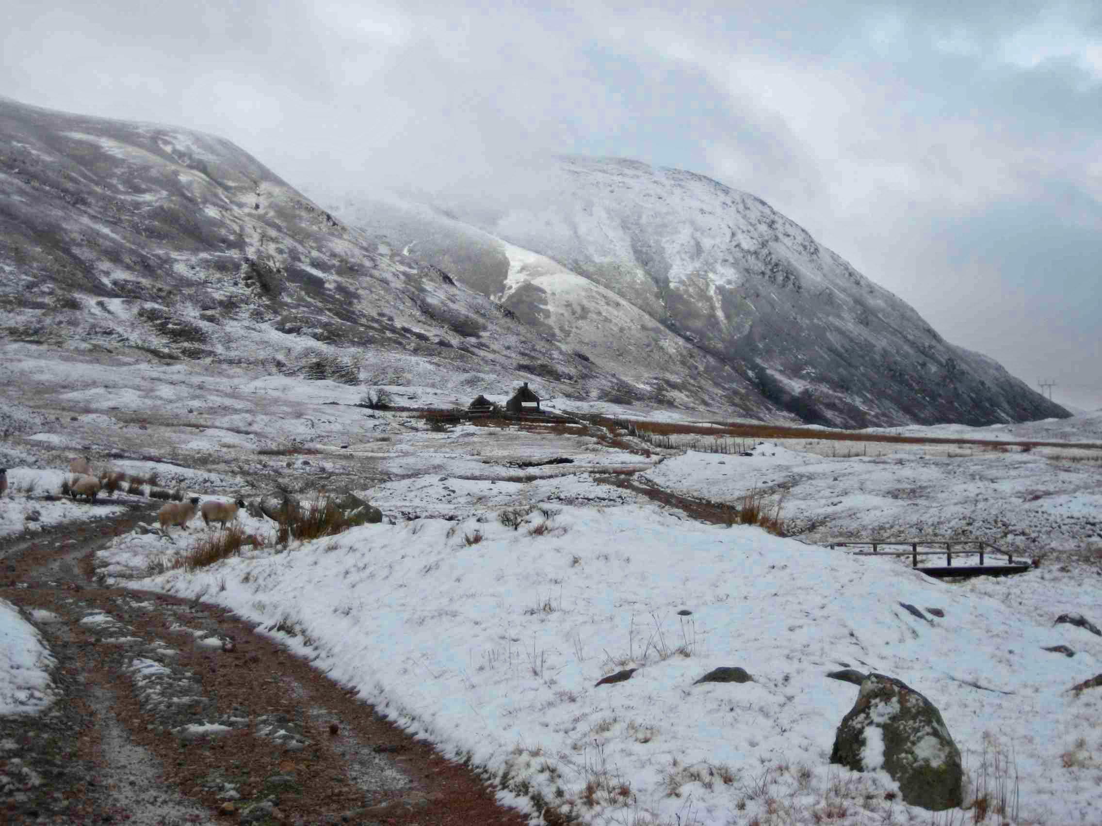
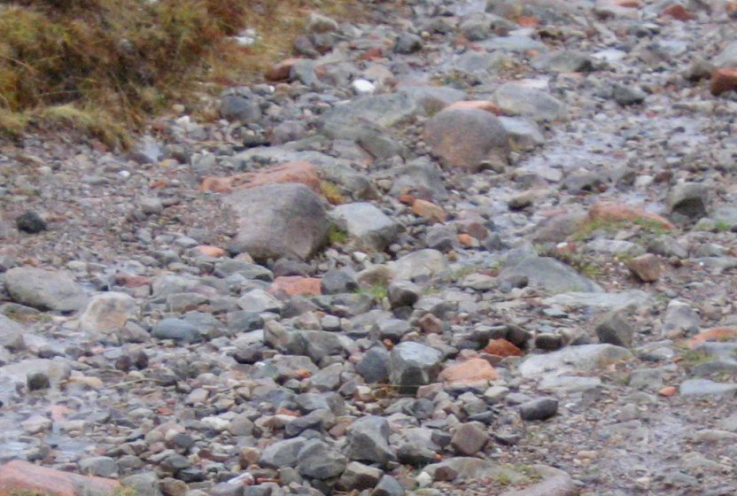
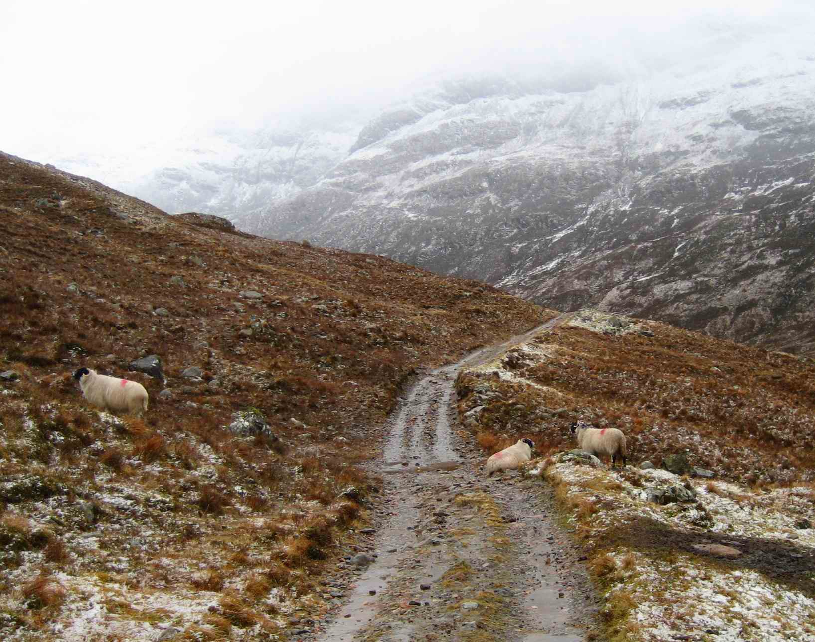
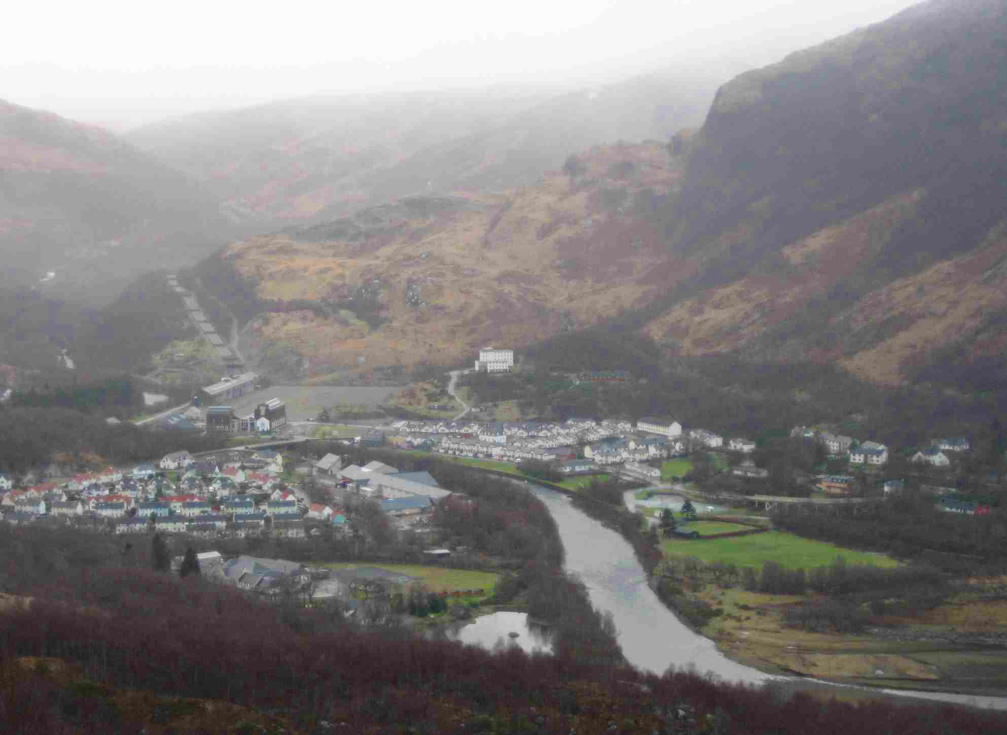
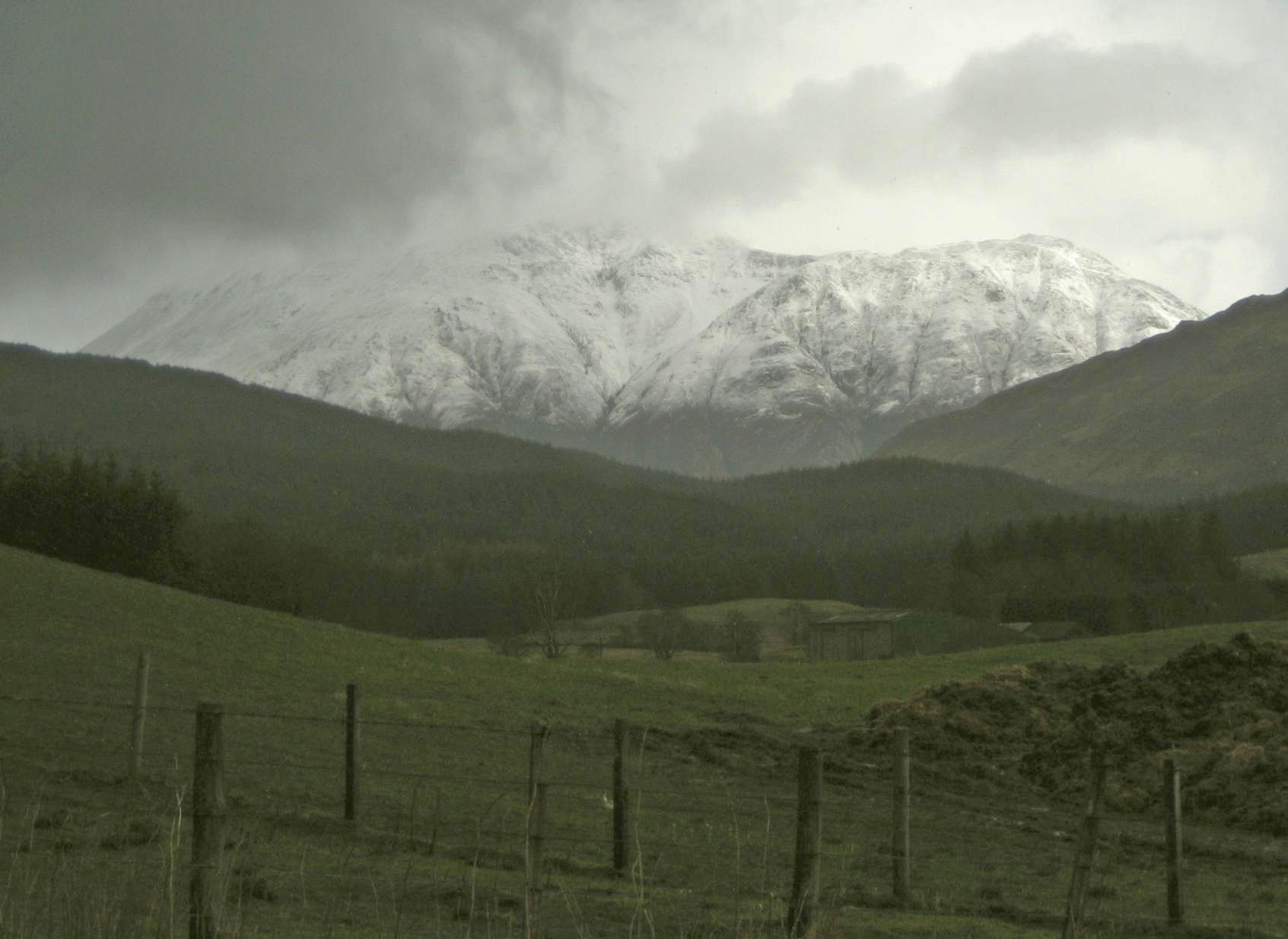
| The
West Highland Way between Fort William and Kinlochleven. Top to bottom: Trail leading to Tigh-na-sleubhaich;typical trail surface; trail about a mile west of Lairigmor; a steep 800 ft descent to Kinlochleven; Ben Nevis, Britain's highest peak |
|
| Days S1 - S20 Scottish Highlands | |
| Southbound
Home Start hiking here Scottish Highlands Central Scotland Southern Scotland North of England English Midlands English West Country Northbound Home |
Sunday, March 9, 2008
Time of departure: 9.00 am Time of arrival: 5.45 pm Place departed: Fort William, Highland Place arrived: Kinlochleven, Highland Miles: 15 Cum miles: 216.7 Percent complete: 22.3  MacDonald Hotel, Kinlochleven
**** MacDonald Hotel, Kinlochleven
****Cost for bed and breakfast: £30 ($60) |
| Overview of both
hikes Excerpts Statistics What others say Acknowledgments Contact me Copyright Links |
|
 |
|
 |
|
|
The West
Highland Way (WHW) National Park Headquarters urges hikers to tackle
the 95-mile WHW in the northerly direction. This allows a warm-up on
the easier southern sections before one tackles the more difficult
northern end. But Hobson did it the other way round.
Fort William to Kinlochleven is just 15 miles, and reaches only 1000 ft, but it was the hardest day's hike of my life. The forecast said today would be mainly sunny - the best weather for a week. But there was no sun. There was rain, hail, sleet and snow, and only occasionally did the precipitation turn to mere mist and murk. Yet that's not what made today difficult. Fort William lies in the shadow of Britain's highest peak, Ben Nevis, just shy of 5000 ft. It's a tourist magnet, with good mountaineering and ski-ing. It's also the reason that many local businesses have Nevis or Ben in their names, as with last night's hotel. I popped into Nevis Sports on my way out of town and bought a better rainjacket and stayed fairly dry all day. That shopping pause caused me to arrive in Kinlochleven minutes before nightfall. But that's not what made today hard either. With much recent rain, the runoff from the mountains crossed the trail, plunging over it in a hundred places, all to be crossed by stepping stones or by detouring to where the stream was narrow enough to jump. Some of the water also coursed along the trail itself, making wet boots inevitable. On the rare occasions that there was a pedestrian bridge, today there was so much water as to cause some of these bridges to flood. But that's not what made today difficult. There are people able to run the entire 95-mile route in less than 24 hours, and I believe someone has done it in 17 hours. A great many people do it in six days without drama. So I readily concede that my difficulty today is a personal one. I don't like walking on rocks and stones. Much of today's trail (half at least) is made of rocks and stones. I found it really difficult to keep my footing, falling twice and twisting my right ankle regularly. My left ankle is less prone to twist, which is just as well. Each step needed planning, and though this became somewhat automatic, it was all so much more difficult than walking nonchalantly on a more manicured surface. While I didn't stop for more than 45 minutes all told, including my Fort William shopping, it took me 8 3/4 hours to do just 15 miles. I normally can do that distance in six or seven hours. The last hour of the day was a steep descent on rocks from 800 ft to sea level in one mile. It was painstaking in every sense of the word. Tomorrow, a severe storm (the worst of the year) is forecast, mainly for England and Wales, but with ten inches of snow on high ground in Scotland, and perhaps strong winds. The forecaster told us about this without mentioning my name explicitly, but I could tell she was thinking of me. Tomorrow's trail goes up higher (to 1800 ft from sea-level) in fewer miles than today's, and then does a more severe version of today's end-of-day descent. In fact, tomorrow's descent is known as the devil's staircase, while today's taxing descent doesn't even have a name. That tells me they didn't name it for the devil without good reason. And remember I have to go down it, which is harder than going up. I want none of it in the poor weather that's forecast, and am contemplating doubling the distance and going on a lengthy detour by road even though that involves Glencoe Pass (1000 ft). That's if the weather is walkable in the first place. And if my boots are dry. And if I can walk at all. There was stupendous scenery today. I took some photos in the wet, hoping the view would feel better in photos than it did while stepping on stones. When I reached Kinlochleven in the dusk, and checked in at the MacDonald Hotel, I treated myself to a pint of Strongbow and a lamb shank at the hotel restaurant. Then I took a long soak in the tub. Ol' Hobson needed all the nurturing he could get. |
|
 |
|
| Day S15 © 2007-2012 Daryl May Day S17 | |