| . Hike Southbound through Britain with Daryl May Click for Northbound hike . |
|
 |
|
| Scottish Highlands | |
Southbound Home Start hiking here Scottish Highlands Central Scotland Southern Scotland North of England English Midlands English West Country Northbound Home |
|
| Overview of both
hikes Excerpts Statistics What others say Acknowledgments Contact me Copyright Links |
|
|
Day S1 Day S2 Day S3 Day S4 Day S5 Day S6 Rest days 1 to 7 Rest days 8 to 15 Day S7 Day S8 Day S9 Day S10 Day S11 Day S12 Day S13 Day S14 Day S15 Day S16 Day S17 Day S18 Day S19 Day S20 |
Headwind in Highland John o' Groats - Lower Reiss A long second day Lower Reiss - Lybster Short and sweet Lybster - Dunbeath Sheer slog Dunbeath - Helmsdale A blistering day Helmsdale - Golspie I need a doctor Golspie - Tain Resting up in Tain Still in Tain On the road again Tain - Alness Still truckin' Alness - Dingwall Back to normal? Dingwall - Kiltarlity The cross-dresser of Kiltarlity Kiltarlity - Lewiston Great Glen Way and Loch Ness Lewiston - Invermoriston Thoughts about Wimpy Invermoriston - Fort Augustus The Caledonian Canal and Loch Oich Fort Augustus - Invergarry Heavy rain on Hobson Invergarry - Letterfinlay Lodge A big milestone Letterfinlay Lodge - Fort William No stone unturned Fort William - Kinlochleven A dog's leg to Glencoe Kinlochleven - Glencoe My father's son Glencoe - King's House A day on Rannoch Moor King's House - Bridge of Orchy For the rain it raineth every day Bridge of Orchy - Crianlarich |
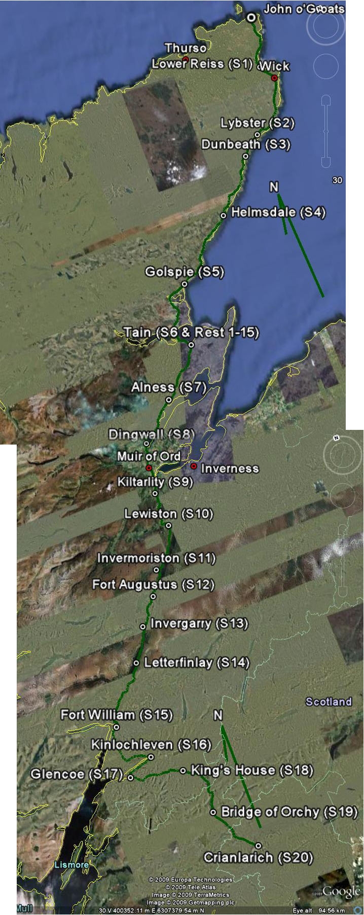
Scottish Highlands map. Read from top down. For an idea of
scale, each day's hike was about 15 miles.
.Click here for a zoomable map of this region. The map was produced using Google Maps and Google Earth. |
|
 |
|
© 2007 - 2009 Daryl May |
|